August 22, 2020
By: Staff Report
PASCO COUNTY, Fla. – Tropical Storm Laura will bring heavy rain into Puerto Rico and the Leeward Islands in the Caribbean Sea that could prompt flash flooding and mudslides.
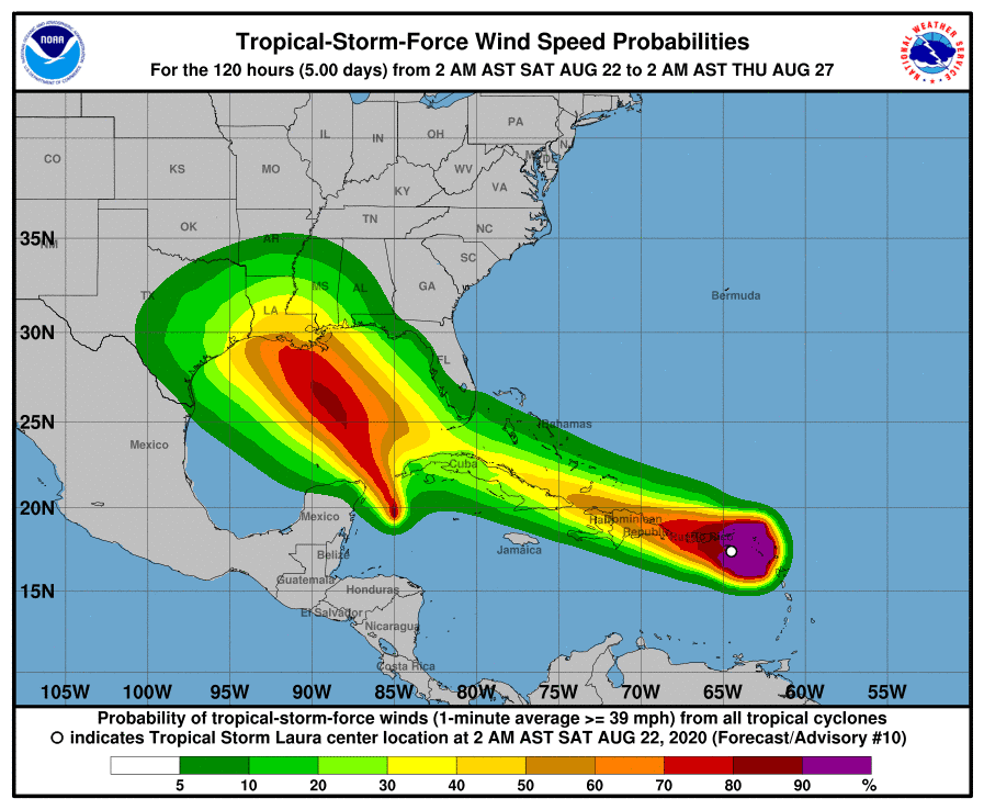
Saturday morning, Tropical Storm Laura was 110 miles from San Juan, Puerto Rico, moving at 21 mph. Tropical Storm Laura is forecast to impact the United States, possibly as a hurricane, sometime next week.

Tropical Storm Marco, which formed Friday night, is expected to strengthen over the Caribbean throughout Saturday and inch closer to the Yucatan Peninsula of Mexico. This storm is expected to impact areas like Cuba and then could make landfall as a hurricane somewhere in the Gulf of Mexico region of the United States, between Texas and Louisiana next week.
Tropical storm conditions are expected across portions of the northern Leeward Islands, the Virgin Islands, and Puerto Rico through today. Tropical storm conditions are also expected along the northern coasts of the Dominican Republic and Haiti, and the Turks and Caicos and southeastern Bahamas Saturday into Sunday. Heavy rainfall is likely across these areas beginning and could cause mudslides and flash and urban flooding through Sunday.
Tropical storm conditions are possible over portions of the central Bahamas Sunday night, as well as portions of eastern and central Cuba Sunday and Sunday night.
The details of the long-range track and intensity forecasts remain more uncertain than usual since Laura is forecast to move near or over portions of the Greater Antilles through Monday. However, Laura could bring storm surge, rainfall, and wind impacts to portions of Cuba, the Bahamas, and Florida early next week and the northern U.S. Gulf Coast by the middle of next week. Interests there should monitor the progress of Laura and updates to the forecast during the next few days.

