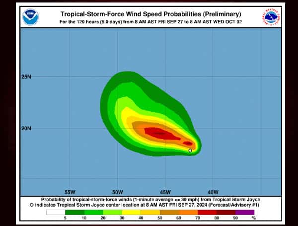
Tropical Storm Joyce, the tenth named storm of the season, has developed in the central tropical Atlantic. Satellite images show a well-defined circulation with organized convection and decent outflow. Joyce currently has 35 kt winds.
Favorable conditions, including low wind shear and warm sea surface temperatures, could allow for some strengthening over the next couple of days. However, increasing wind shear and dry air are expected to limit intensification. The official forecast predicts Joyce will reach a peak of 50 kt on Saturday before gradually weakening. By Tuesday, the storm is expected to dissipate into a remnant low or trough.
Read: Hurricane Helene Weakens To Tropical Storm After Florida Landfall
Joyce is currently moving northwestward at 11 kt. A weak ridge will steer it northwestward for the next day or so, followed by a gradual turn to the north and a slowdown. Models are in good agreement on this track, and the official forecast aligns with consensus aids.
Key Points:
- Tropical Storm Joyce has formed in the central tropical Atlantic.
- Limited intensification is expected due to increasing wind shear and dry air.
- Joyce is forecast to peak at 50 kt on Saturday before weakening.
- The storm will track generally northwestward, then turn northward and slow down.
- Joyce is expected to dissipate into a remnant low or trough by Tuesday.
Please make a small donation to the Tampa Free Press to help sustain independent journalism. Your contribution enables us to continue delivering high-quality, local, and national news coverage.
Android Users: Download our free app to stay up-to-date on the latest news.
Connect with us: Follow the Tampa Free Press on Facebook and Twitter for breaking news and updates.
Sign up: Subscribe to our free newsletter for a curated selection of top stories delivered straight to your inbox.


