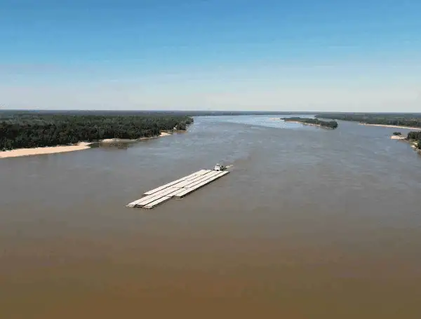
A prolonged flood event is beginning to unfold along the lower Mississippi River, a consequence of the widespread heavy rainfall that drenched the river basin in early April.
Experts predict the high water will persist until nearly the end of the month, and potentially into May in some locations, posing significant challenges to communities, agriculture, and river commerce.
The Mississippi River’s immense size and its winding path across relatively flat terrain mean that floodwaters travel slowly downstream. It can take weeks for the surge of water currently moving past the Ohio River confluence to reach the Gulf of Mexico, extending the flood cycle over a month for the lower portion of the river.
READ: Colorado State University Researchers Forecast Above-Average 2025 Atlantic Hurricane Season
As the river swells beyond its banks, it is expected to inundate unprotected farmland and low-lying communities. Due to the flat landscape and poor drainage typical of the region, this floodwater could linger for many days or even weeks, long after the river crest passes.
Agricultural operations face significant disruption, as fields will remain saturated and unworkable for extended periods even after the water recedes, dependent on drying conditions.
While the crest on the lower Ohio River is expected this weekend, signalling the start of a slow recession there over the coming weeks, downstream locations on the Mississippi are just beginning their rise. Levees along the river will face sustained pressure, and authorities anticipate closures of some roads and bridge access points for potentially many days. Communities without levee protection are bracing for prolonged periods of high water.
Specific forecast points illustrate the slow progression:
- Osceola, Arkansas: The Mississippi River is forecast to crest sometime during the third week of April (approximately April 14-20), significantly exceeding the major flood stage of 35 feet.
- Vicksburg, Mississippi: A crest is not anticipated until around April 21. Depending on rainfall patterns in the coming days, the river may not fall back within its banks here until early May.
- Baton Rouge, Louisiana: Located roughly 450 miles downstream from the Ohio confluence, the river is not projected to crest at a major flood stage until the last week of April.
READ: AccuWeather Predicts Active 2025 Hurricane Season; Florida, Texas, Louisiana At Elevated Risk
Officials caution that assuming no further significant rain events occur across the vast river system, it will likely be well into May before the Mississippi returns to normal levels throughout its lower reaches.
The flooding also presents obstacles for river transportation, a crucial and typically cost-effective method for moving goods like grain and raw materials.
The combination of high water levels, faster-than-average currents, and potentially reduced clearance under bridges will likely force towboats to handle fewer barges or reduce their loads. Additionally, some ports downstream of St. Louis may face temporary closures due to the high water.
On a positive note, weather forecasts currently show no major widespread rain events expected until at least Wednesday or Thursday of the upcoming week.
READ: Florida Woman Scratches Off $1 Million Win On Crossword Lottery Ticket
This offers a window of favourable drying conditions for cleanup and repairs in the Tennessee and Ohio valleys where waters have already started to recede. However, forecasters remain watchful, as later weather systems could bring the potential for severe weather, including tornadoes, and renewed localized flooding, possibly impacting areas previously unaffected.
Please make a small donation to the Tampa Free Press to help sustain independent journalism. Your contribution enables us to continue delivering high-quality, local, and national news coverage.
Connect with us: Follow the Tampa Free Press on Facebook and Twitter for breaking news and updates.
Sign up: Subscribe to our free newsletter for a curated selection of top stories delivered straight to your inbox.
