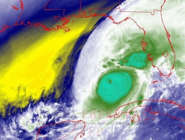
Hurricane Milton, a powerful Category 4 storm, continues its march towards Florida’s west coast with maximum sustained winds of 125 mph and gusts reaching 150 mph. The National Hurricane Center (NHC) expects landfall tonight.
As of 11:00 AM EDT, the eye of the storm was located about 120 miles west-southwest of Tampa Bay, moving northeast at 15 mph.
READ: Tampa Bay Bridges Slam Shut As Hurricane Milton Looms
Weakening Trend, But Still Dangerous
While Milton is expected to weaken somewhat before landfall due to increasing wind shear, it is still forecast to be a major hurricane (Category 3 or higher) when it hits the coast.
Impacts
- Storm Surge: Life-threatening storm surge inundation of 10 feet or greater is possible along portions of Florida’s west-central coast.
- Winds: Hurricane-force winds are expected in the warning area, with the potential for widespread power outages and damage.
- Rainfall: Heavy rainfall could produce catastrophic flash and urban flooding, as well as river flooding, across the Florida Peninsula.
READ: Category 4 Hurricane Milton On Collision Course With Florida: Landfall Imminent
Track Forecast
Milton is expected to cross the Florida Peninsula tonight and emerge over the Atlantic Ocean tomorrow. It will then continue to weaken as it moves northeastward, transitioning into a post-tropical cyclone by Friday.
Uncertainty and Importance of Preparedness
The NHC emphasizes that the exact landfall location and intensity of Milton at landfall remain somewhat uncertain. Even small deviations in track can significantly affect the location and magnitude of impacts.
Residents in the affected areas are urged to closely monitor updates from the NHC and local officials, and to complete any remaining preparations immediately. Heed all evacuation orders and warnings.
Key Messages:
- Life-threatening storm surge is imminent. Evacuate if ordered to do so.
- Destructive winds are expected. Prepare for power outages and potential damage.
- Heavy rainfall and flooding are likely. Be aware of the potential for flash flooding and river flooding.
This is a dangerous storm. Stay informed and take all necessary precautions to protect yourself and your loved ones.
Please make a small donation to the Tampa Free Press to help sustain independent journalism. Your contribution enables us to continue delivering high-quality, local, and national news coverage.
Android Users: Download our free app to stay up-to-date on the latest news.
Connect with us: Follow the Tampa Free Press on Facebook and Twitter for breaking news and updates.
Sign up: Subscribe to our free newsletter for a curated selection of top stories delivered straight to your inbox.

