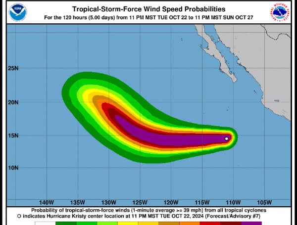
Hurricane Kristy is undergoing rapid intensification in the eastern Pacific, with satellite imagery showing a developing eye and favorable conditions for further strengthening. The storm’s intensity has been increased to 85 knots (98 mph), and it is expected to continue strengthening over the next 36 hours.
Kristy is currently moving west-northwest at 17 knots (20 mph). This motion is expected to continue for the next day or so, after which Kristy will turn northwestward towards a break in the subtropical ridge. Beyond 72 hours, strong upper-level winds are forecast to shear the cyclone apart, with the low-level circulation turning westward.
READ: Hurricane Milton Insured Losses Approach $2.75 Billion In Florida, Over 230K Claims Filed
Favorable environmental conditions, including light wind shear and warm sea surface temperatures, are expected to support continued intensification over the next 36 hours. Forecasters predict Kristy could reach a peak intensity of 120 knots (138 mph), but acknowledge the possibility of the hurricane exceeding this intensity based on current trends.
Later in the forecast period, increasing wind shear and cooler sea surface temperatures should cause Kristy to weaken. The system is expected to weaken to a tropical storm within 96 hours and dissipate into a remnant low-pressure area shortly thereafter.
Please make a small donation to the Tampa Free Press to help sustain independent journalism. Your contribution enables us to continue delivering high-quality, local, and national news coverage.
Android Users: Download our free app to stay up-to-date on the latest news.
Connect with us: Follow the Tampa Free Press on Facebook and Twitter for breaking news and updates.
Sign up: Subscribe to our free newsletter for a curated selection of top stories delivered straight to your inbox.


