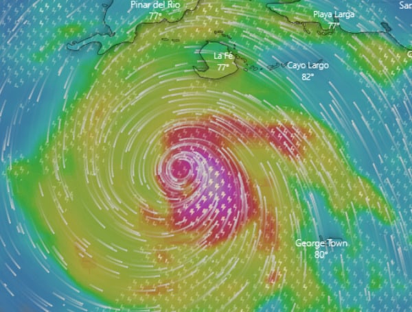
On Monday afternoon, Hurricane Ian reached Category 2 strength as it barrels toward Florida.
Additional rapid strengthening was expected throughout the day. Wind and storm surge impacts were forecast for Western Cuba.
At 5 p.m. Monday, Ian was 155 miles southeast of the western tip of Cuba, had maximum sustained winds of 100 mph and was moving north-northwest at 13 mph.
Tropical storm conditions are possible within 48 hours. A Tropical Storm Warning was issued for Polk County and evacuations were ordered for portions of Pasco County.
In the news: Pinellas County Sheriff Restricting Access To Barrier Islands In Preparation For Hurricane Ian
“A turn toward the north with a slightly slower forward speed is expected on Tuesday. A turn toward the north-northeast with a further reduction in forward speed is forecast on Wednesday. On the forecast track, the center of Ian is expected to move near or over western Cuba tonight and early Tuesday. Ian will then emerge over the southeastern Gulf of Mexico on Tuesday, pass west of the Florida Keys late Tuesday, and approach the west coast of Florida on Wednesday into Thursday,” The National Hurricane Center said.
The Florida Keys are forecast to get 4 to 6 inches of rain, while Central-West Florida is expected to get 8 to 10 inches. The remainder of the Florida Peninsula is forecast to get 3 to 8 inches.
According to the NHC, Ian is expected to remain at or near major hurricane strength as it passes near the west-central coast of Florida on Wednesday and Thursday. Forecasters say Ian is expected to slow down as it hits the coast of Florida, which may prolong the storm surge, wind, and rainfall impacts along the affected portions of the west coast of Florida.
In the news: Pasco County Issues Evacuations For Zones A, B, & C
A few tornadoes are possible late Monday night and Tuesday across the Florida Keys and the southern and central Florida Peninsula.
Visit Tampafp.com for Politics, Sports, and National Headlines. Support journalism by clicking here to our GiveSendGo or sign up for our free newsletter by clicking here.
Android Users, Click Here To Download The Free Press App And Never Miss A Story. Follow Us On Facebook Here Or Twitter Here.
Copyright 2022 The Free Press, LLC, tampafp.com. All rights reserved. This material may not be published, broadcast, rewritten, or redistributed.

