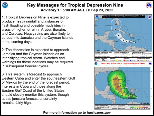
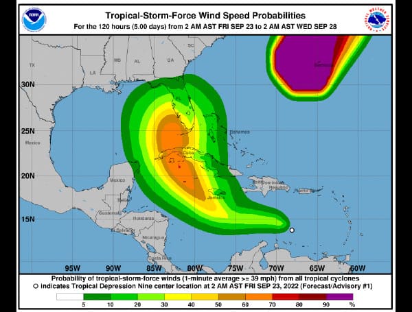
Tropical Depression Nine formed in the Caribbean on Friday with a path that could bring it to the Florida coast next week as Hurricane Hermine.
In its 5 a.m. update, the National Hurricane Center (NHC) said the storm is moving west-northwest at 13 mph. Experts expect it will move more westward over the next day or so before turning back west-northwest and then northwest over the weekend.
Maximum sustained winds are near 35 mph (55 km/h) with higher gusts.
The five-day path has it heading north by Tuesday over Cuba and then parked off Florida’s southwest coast as a Category 2 hurricane with 110 mph winds and gusts of 130 mph by Wednesday morning.

Swells generated by this system will begin affecting Jamaica, the Cayman Islands, and Cuba over the next several days. These swells are likely to cause life-threatening surf and rip current conditions.
Visit Tampafp.com for Politics, Sports, and National Headlines. Support journalism by clicking here to our GiveSendGo or sign up for our free newsletter by clicking here.
Android Users, Click Here To Download The Free Press App And Never Miss A Story. Follow Us On Facebook Here Or Twitter Here.
Copyright 2022 The Free Press, LLC, tampafp.com. All rights reserved. This material may not be published, broadcast, rewritten, or redistributed.

