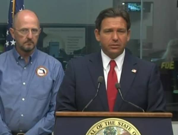
Florida Governor Ron DeSantis, joined by state emergency and law enforcement officials, provided an update on preparations for Hurricane Milton as it approaches Florida’s west coast and begins landfall.
The storm, currently a Category 3 hurricane with maximum sustained winds of 120 mph, is expected to make landfall in Sarasota County tonight or early Thursday, then move across central Florida into the Atlantic by Thursday afternoon.
The hurricane has shown signs of weakening over the past 24 hours. However, its increased speed means it will hit the Gulf Coast before high tide, potentially helping to reduce the impact of storm surge.
WATCH: Hurricane Milton Pre-Landfall In Pasco County, Florida
Heavy rain and dangerous storm surge are expected along both the west and east coasts of Florida. Peak storm surge is forecasted to be between 5 to 13 feet, with the highest surge expected from the Charlotte-Lee County line to Anna Maria Island in Manatee County.
READ: Hurricane Milton Weakens Slightly, But Remains A Major Threat To Florida’s West Coast
Ongoing Response Efforts:
- State Missions & Resources: Florida completed nearly 2,000 missions before landfall, including staging generators at shelters and preparing fuel reserves. Florida Highway Patrol is on standby to escort fuel trucks once ports reopen.
- FDOT Preparations: The Florida Department of Transportation is ready to mobilize with 156 bridge inspectors, 402 personnel for road clearing, over 1,000 generators, and 350 pieces of heavy equipment.
- Search & Rescue Teams: Search and rescue personnel and equipment are on standby. This includes state and local teams, National Guard units, and task forces from other states.
- Power Restoration: More than 50,000 linemen are pre-staged throughout Florida, ready to begin power restoration efforts once conditions are safe.
- Evacuation Status: With the storm now close to landfall, evacuation is no longer safe in many areas. Residents are urged to shelter in place, as the hurricane will likely cause widespread power outages and hazardous conditions.
Key Safety Reminders:
- Prepare for Power Outages: Power outages will continue to increase as the storm progresses. Use generators safely—never run them indoors and keep them away from windows and doors.
- Stay Indoors: Even if conditions seem calm, you could be in the eye of the storm, which means dangerous weather will soon resume. Follow local emergency management officials’ guidance on when it is safe to go outside.
- Beware of Floodwaters: Flooding and storm surge present life-threatening dangers, including hazards from debris in the water. Do not venture into floodwaters.
- Report Dangerous Conditions: Report any unsafe situations to local authorities to help protect the community.
Tornado Threats:
Since the storm’s approach, there have been 116 tornado warnings across the state, with 19 confirmed touchdowns, and additional flash flood warnings and flood watches are in place. Tornadoes and high winds remain a threat, especially on the storm’s northern side.
Coordination and Support:
Governor DeSantis thanked the many agencies and personnel involved in the response, including the National Guard, Florida Highway Patrol, Florida Fish and Wildlife Conservation Commission, and law enforcement. Task forces from Virginia, Ohio, and Miami are also assisting in areas impacted by tornadoes.
“Florida is prepared to respond quickly and effectively,” said DeSantis. “Despite the fatigue from Hurricane Helene, our teams are ready to tackle this challenge head-on. We have massive amounts of resources and personnel standing by, and we will not rest until every Floridian is safe and our communities are restored.”
Please make a small donation to the Tampa Free Press to help sustain independent journalism. Your contribution enables us to continue delivering high-quality, local, and national news coverage.
Android Users: Download our free app to stay up-to-date on the latest news.
Connect with us: Follow the Tampa Free Press on Facebook and Twitter for breaking news and updates.
Sign up: Subscribe to our free newsletter for a curated selection of top stories delivered straight to your inbox.
