Hurricane and storm-surge watches were issued Tuesday for much of Florida’s Gulf Coast, as a developing weather system is expected to rapidly intensify into “a potentially very dangerous storm,” likely making landfall as Hurricane Helene later this week.
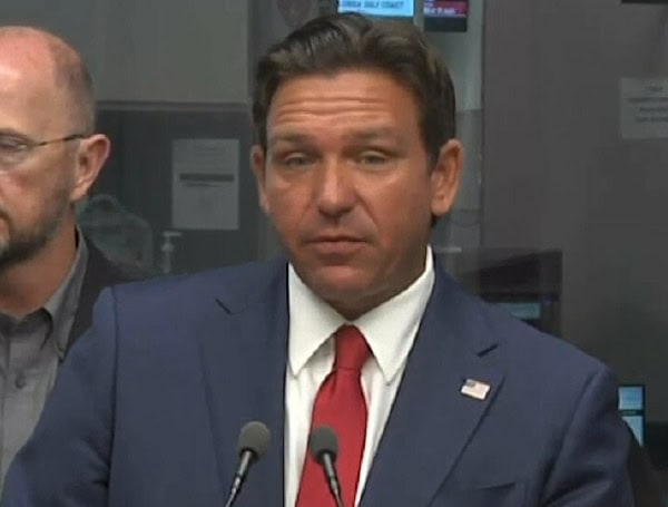
Governor Ron DeSantis expanded a state of emergency to 61 of Florida’s 67 counties, with only parts of Southeast Florida excluded. On Monday, DeSantis had already declared a state of emergency for 41 counties and has now requested a federal emergency declaration in anticipation of the storm.
Read: Florida Prepares Special Needs Shelters As Tropical Cyclone Nine Approaches
Speaking at the state Emergency Operations Center, DeSantis noted the storm’s potential strength, stating, “The fact that this is forecasted to become a major hurricane even before its formation highlights the potential for a significant event.”
The storm is projected to hit North Florida, particularly the Big Bend and Panhandle regions, both of which have experienced substantial hurricane damage in recent years. Hurricane Michael devastated the Panhandle in 2018 with 160 mph winds, while Hurricane Idalia in 2023 and Hurricane Debby this year both impacted the Big Bend area.
DeSantis warned that the storm’s effects could extend 100 to 200 miles from its center, bringing dangerous conditions far beyond its immediate path. Duke Energy Florida has already begun preparing for potential power outages.
Read: Florida Braces For Hurricane Helene, DeSantis Declares State Of Emergency
“While the storm’s path and intensity are still uncertain, we are ready to respond as quickly as possible should disruptions occur,” said Melissa Seixas, Duke Energy Florida state president. She encouraged customers to prepare in advance and gather necessary supplies.
To aid in recovery efforts, DeSantis said 18,000 utility workers are being pre-positioned across the state, and 3,000 members of the Florida National Guard and Florida State Guard have been activated.
Florida’s Division of Emergency Management Executive Director Kevin Guthrie urged residents to complete their preparations, including filling up their gas tanks and stocking up on at least seven days’ worth of food and water. Local evacuation orders are expected to be issued on Wednesday.
The National Hurricane Center gave the storm system a “near 100 percent” chance of forming into a hurricane within the next 48 hours. The system is expected to bring strong winds to Southwest Florida as early as Wednesday, with significant impacts forecast for Thursday along the northeastern Gulf Coast.
Read: Florida Senators Urge Biden To Approve Pre-Landfall Emergency Declaration Ahead Of Hurricane Helene
In its advisory, the hurricane center warned, “The system is expected to intensify into a major hurricane before approaching the northeastern Gulf Coast on Thursday. Life-threatening storm surge and damaging hurricane-force winds are increasingly likely along the coast of the Florida Panhandle and the Florida west Gulf Coast.”
As of Tuesday morning, the storm had maximum sustained winds of 35 mph and was located about 205 miles south-southeast of the western tip of Cuba.
Hurricane watches are in effect from Englewood, Florida, to Indian Pass in Gulf County, while storm surge watches cover areas from Indian Pass to Flamingo in Monroe County. Storm surge in Tampa Bay is expected to exceed five feet, with heights of more than 10 feet projected from the Ochlockonee River to the Chassahowitzka River.
Please make a small donation to the Tampa Free Press to help sustain independent journalism. Your contribution enables us to continue delivering high-quality, local, and national news coverage.
Android Users: Download our free app to stay up-to-date on the latest news.
Connect with us: Follow the Tampa Free Press on Facebook and Twitter for breaking news and updates.
Sign up: Subscribe to our free newsletter for a curated selection of top stories delivered straight to your inbox.


