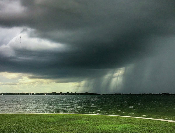
A major severe weather outbreak is expected to impact a large swathe of the central and eastern United States this week, bringing the risk of tornadoes, damaging winds, hail, and flash flooding. The storm system, which is currently developing, will affect nearly two dozen states and put 170 million people at risk from the Southern Plains to the Midwest and East Coast.
The main threat from severe weather will be powerful wind gusts that can knock over trees and cut the power in some communities from Texas and Oklahoma to portions of Florida, Michigan, New York, Pennsylvania and New Jersey.
READ: “Hoarder’s Paradise” Turns Into Prison: North Carolina Locaks Boyfriend In Storage Unit To Die
There is also a risk of a dozen or two tornadoes spinning up in the strongest storms, and part of that threat will exist during the nighttime hours in the Central states.
Wind energy from the storm will first be felt over portions of the southern Rockies and Plains beginning at the end of the weekend. Gusts frequenting 50-70 mph in the mainly clear, dry air, combined with the dry winter brush, will significantly boost the risk of wildfires through Tuesday.
As a trailing cold front associated with the storm begins to encounter moisture from the Gulf late Monday and Monday night, thunderstorms will erupt.
At this early stage of the severe weather outbreak, the main threat will be from powerful wind gusts during Monday night from central Texas to much of Oklahoma and southern Kansas. However, this will only mark the beginning or ramp-up phase of the severe weather.
READ: Pentagon Deploys Stryker Brigade To U.S.-Mexico Border As Trump Touts Historic Low Illegal Crossings
On Tuesday, thunderstorms are likely to waste little time becoming severe, with the main threat continuing from powerful wind gusts. Because of the scope and intensity of the thunderstorms, AccuWeather meteorologists believe there is a high risk of severe weather that represents a widespread threat from northeastern Texas to southwestern Tennessee. This area may also be the most prone to tornadoes, with that threat continuing after dark, adding to the danger.
Strong crosswinds associated with some of the storms will pose a significant risk of high-profile vehicle rollovers.
From Tuesday to Tuesday night, a massive area with few to numerous severe thunderstorms will extend from south Texas to Kansas, Missouri, Illinois, Indiana, Ohio and the Florida Panhandle. In addition to the likelihood of high winds and a few tornadoes, some of the storms will produce damaging hail and lightning, as well as flash flooding.
As the storm lifts northward toward the Upper Midwest, the threat of severe weather will be carried into the Great Lakes region, part of the Atlantic Seaboard and the northeast Gulf coast on Wednesday and Wednesday night. There can even be thunder and lightning with gusty winds as far to the north as the St. Lawrence Valley and eastern New England.
READ: Lakeland Man’s Nap In Auburndale Interrupted By Polk County Deputies, Wakes Up To New Charges
Once again, the main threats will stem from high wind gusts on Wednesday. Still, there is the risk of a few brief tornadoes, as well as some storms capable of producing hail and flash flooding.
Most of the major and secondary airport hubs from the Mississippi Valley to the Atlantic coast will be affected by thunderstorms or strong winds that can lead to flight delays.
As the storms and their associated wind shear and lightning advance to the east and northeast, their approach at the major airport hubs will trigger ground stops, flight delays and potentially flight cancellations.
The outbreak of severe weather will pose some risk to lives and property from Monday night to Wednesday evening. The most far-reaching impacts from the storms may be power outages that could span nearly two dozen states.
While flash urban flooding can occur anywhere thunderstorm activity is associated with this March storm, the most widespread risk of small stream and river flooding will exist in areas where heavy rains have recently occurred this spring, such as in portions of the Ohio and Tennessee Valley.
However, the combination of rapidly melting snow along with a more moderate rate of rainfall can lead to quick flooding of streams and rivers in the northern tier of the Midwest and Northeast, as well as the southern tier of Canada.
Please make a small donation to the Tampa Free Press to help sustain independent journalism. Your contribution enables us to continue delivering high-quality, local, and national news coverage.
Connect with us: Follow the Tampa Free Press on Facebook and Twitter for breaking news and updates.
Sign up: Subscribe to our free newsletter for a curated selection of top stories delivered straight to your inbox.

