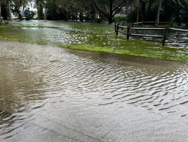
CITRUS COUNTY, Fla. – Several areas of Citrus County are already heavily flooded and high tide coming in at 4:30 p.m. today.
“Please remain inside and shelter in place. While we persevered through most of the storm, there is still catastrophic storm surges possible,” said Citrus County Sheriff’s Office.
Storm surges are highly dangerous and pose several significant dangers such as rapid and extensive flooding.
The surge of water driven by strong winds and low pressure from Hurricane Idalia can inundate low-lying regions – especially those in evacuation Zone A, causing significant property damage and putting lives at risk.
The powerful currents within storm surges can be incredibly swift and forceful. These currents can easily sweep away vehicles, debris, and even people, making it extremely hazardous for anyone caught in the surge.
Fort Island Trail is closed as water is rising and tide gauges are reading a rapid increase in water levels.
It’s important for residents in vulnerable coastal areas to stay informed about weather forecasts from our office. Please plan to stay and shelter in place for the remainder of the day and into the evening due to the potential severity of storm surges. This event is not over yet.
Again, please wait until after the surge has passed and water levels begin to recede before venturing out while conditions will still be hazardous.
Android Users, Click To Download The Free Press App And Never Miss A Story. Follow Us On Facebook and Twitter. Signup for our free newsletter.
We can’t do this without your help; visit our GiveSendGo page and donate any dollar amount; every penny helps


