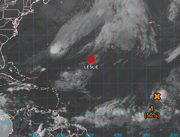
The National Hurricane Center (NHC) is monitoring a weather disturbance near the Cabo Verde Islands that has a medium chance of developing into a tropical storm within the next few days.
The system, currently bringing strong winds and heavy rain to the islands, is showing some signs of organization. However, its circulation remains elongated and the associated showers and thunderstorms are still disorganized.
Despite these challenges, the NHC gives the disturbance a 50% chance of becoming a short-lived tropical storm as it moves westward or west-northwestward at 10 to 15 mph across the eastern tropical Atlantic.
READ: Lakeland Man With Alzheimer’s Found Dead After Wandering From Flooded Home
Environmental conditions are expected to become less favorable for development by Saturday, making further intensification unlikely after that time.
Impacts:
Regardless of whether this system develops into a tropical storm, it is expected to continue generating tropical-storm-force winds and heavy rainfall over portions of the Cabo Verde Islands through tonight.
Other Active Systems:
The NHC is also monitoring Tropical Storm Leslie, which is currently located over the central subtropical Atlantic Ocean.
Please make a small donation to the Tampa Free Press to help sustain independent journalism. Your contribution enables us to continue delivering high-quality, local, and national news coverage.
Android Users: Download our free app to stay up-to-date on the latest news.
Connect with us: Follow the Tampa Free Press on Facebook and Twitter for breaking news and updates.
Sign up: Subscribe to our free newsletter for a curated selection of top stories delivered straight to your inbox.


