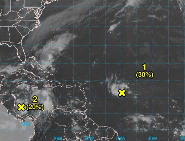
The National Hurricane Center in Miami is monitoring two weather systems in the Atlantic basin that have a chance of developing into tropical depressions or storms.
System 1: Near the Leeward Islands
A disturbance east of the Leeward Islands is showing signs of organization, with satellite data indicating a possible circulation. While the system is currently producing disorganized showers and thunderstorms, conditions are favorable for gradual development as it moves west-northwestward.
READ: Florida AG Ashley Moody Warns Floridians To Avoid Scams Amid Hurricane Relief Donations
It could become a tropical depression as it approaches the Leeward and Virgin Islands late this week.
- Chance of formation in the next 48 hours: Low (30%)
- Chance of formation in the next 7 days: Medium (40%)
System 2: Western Caribbean Sea
A broad area of low pressure in the southwestern Caribbean Sea is generating showers and thunderstorms. This system has a chance to develop gradually as it drifts northwestward toward Central America. Even if it doesn’t become a tropical depression or storm, it could bring heavy rainfall to parts of Central America and southern Mexico later this week and into the weekend.
READ: Treasure Island Quadruples Debris Collection Efforts After Hurricanes
- Chance of formation in the next 48 hours: Low (20%)
- Chance of formation in the next 7 days: Low (20%)
Please make a small donation to the Tampa Free Press to help sustain independent journalism. Your contribution enables us to continue delivering high-quality, local, and national news coverage.
Android Users: Download our free app to stay up-to-date on the latest news.
Connect with us: Follow the Tampa Free Press on Facebook and Twitter for breaking news and updates.
Sign up: Subscribe to our free newsletter for a curated selection of top stories delivered straight to your inbox.

