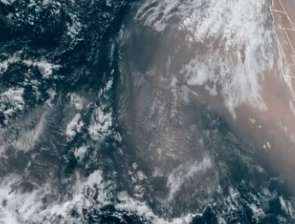
The Saharan Air Layer looks like Atlantic high pressure, and its associated clockwise flow of air will bring the dust phenomena to the Sunshine State.
According to FOX 35, current forecast models show the dust entering the southern Gulf by this weekend. From there, the dust advances into much of Florida.
As high pressure remains the dominant feature on the map through early next week, another batch is possible by next Tuesday.
Some good news is that the Saharan dust blanket does tamp down the development of hurricanes. The hurricane season begins June 1 and runs through Nov. 30.
More good news with this. Get ready for some beautiful sunsets. Florida is already home to some of the best sunrises and sunsets in the world, but they can be even better when the dust is added to the atmosphere.
When the sun is low on the horizon in the morning and evening, the sun’s rays have to travel through more of the Earth’s atmosphere. The light scatters more, producing beautiful red, orange, and pink colors in the sky.
When the small dust particles are introduced to this light, more scattering occurs, enhancing the already vibrant colors.
For the bad news.
People with respiratory issues may need to limit time outdoors when the dust levels are elevated. Those unusually sensitive to dust may experience allergy-like symptoms, including eye and nose irritation, sneezing, and post-nasal drip.
Visit Tampafp.com for Politics, Tampa Area Local News, Sports, and National Headlines. Support journalism by clicking here to our GiveSendGo or sign up for our free newsletter by clicking here.
Android Users, Click Here To Download The Free Press App And Never Miss A Story. Follow Us On Facebook Here Or Twitter Here.

